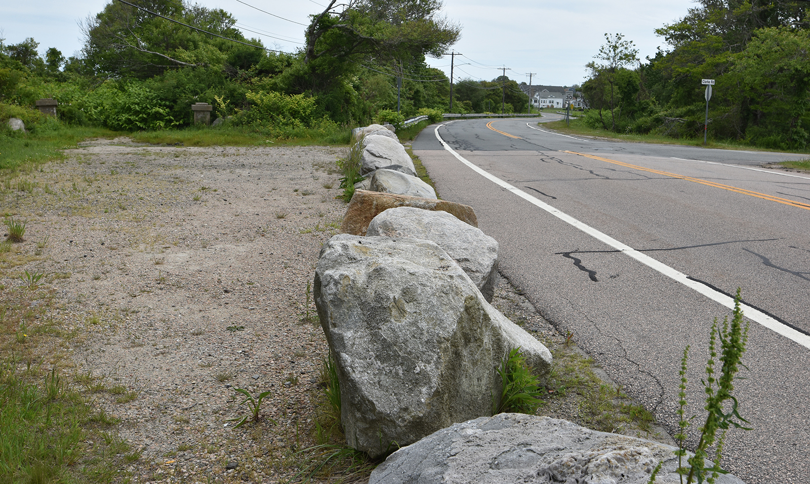
Boulders Placed in Shoreline Parking Areas Restrict Access
By Rob Smith / ecoRI News staff
Some
popular fishing and coastal access spots have less parking this summer. Two
areas managed by the Rhode Island Department of Environmental Management (DEM)
have had their parking reduced since the onset of the pandemic: the Camp Cronin
Fishing Area near Point Judith Lighthouse and the Black Point Trail on Ocean
Road.
Parking
has become a flashpoint for shoreline activists, as municipalities often use
parking restrictions as a way to bar passage to various shoreline access
points. While the Rhode Island Public Transit Authority, particularly during
the summer, does have some routes to beaches and nearby areas in Narragansett,
a ride on RIPTA can take up to 30 minutes longer than driving from Kennedy
Plaza to Point Judith.
DEM
confirmed parking reductions at each site, but only claimed responsibility for
one. The state agency cited congestion and crowding issues during the height of
the pandemic’s first wave in summer 2020 as a reason for the change.
“The parking configurations [at Camp Cronin] were changed during COVID to ensure law enforcement and emergency personnel vehicles could access the fishing areas in case of medical and other emergencies,” DEM spokesperson Jay Wegimont said.
The Camp Cronin Fishing Area,
split off in 1985 from a larger parcel of the same name owned by the city of
Providence, hosts a lookout point, a rocky promontory popular for fishing, and
a small beach. DEM officials placed a number of boulders and no parking signs,
significantly reducing the number of spots in the dirt lot from pre-pandemic
levels.
Further up the coast from Point Judith is another popular DEM-managed area, Black Point Trail. Just up the road from Scarborough State Beach, the trail is accessed by a main entrance on Ocean Road maintained by DEM.
The
property boasts 2.1 miles in trails, gorgeous coastal vistas, and the
picturesque seaside ruins of a mansion.
But
before the pandemic local residents commonly used a spot further down to
pullover or park and access the trails to the shore. This secondary lot, which
has a capacity of about five cars if people reasonably park, has been blocked
off by a series of boulders. At the back of the dirt lot is a pair of concrete
pillars and an overgrown asphalt road that leads toward the shoreline.
“That
is not an official entrance to Black Point,” Wegimont said. “We don’t use that
entrance at all.”
Satellite
photos from Google Maps show the secondary lot being used for parking as late
as September 2019.
The
lot itself becomes a bit of a multi-jurisdictional mess to sort through. DEM
manages the whole parcel of land from street to shore, from the trails to everything
in between. But the parking lot is managed by the Rhode Island Department of
Transportation (DOT).
The
town’s Coastal Access Improvement
Council (CAIC) discovered it wasn’t as easy as it thought to
reopen the trail. Formed in 2021, the group took the smaller parking lot at
Black Point as an initial project.
“We
wanted to see what we could do, perhaps even open that up,” said CAIC chair
Cinna Zerquera-Martin at a Coastal Resources Management Council-hosted webinar
on public shoreline access held last month.
CAIC
recommended to the Town Council that it ask the town administrator to ask DEM
to remove the boulders, but town officials did not get the response they were
expecting.
“We
had multiple jurisdictions in control of that area,” Zerquera-Martin said. “But
our work did pave the way for a group of private citizens to form the Friends
of Black Point to try and weed through DEM, DOT, and the town.”
Friends of Black Point is working on a memorandum
of understanding with DEM, according to Zerquera-Martin.
The
agency meanwhile said it is working to ensure access at the Black Point
trailhead.
“DEM
is committed to preserving access to all our fishing areas,” Wegimont said.
