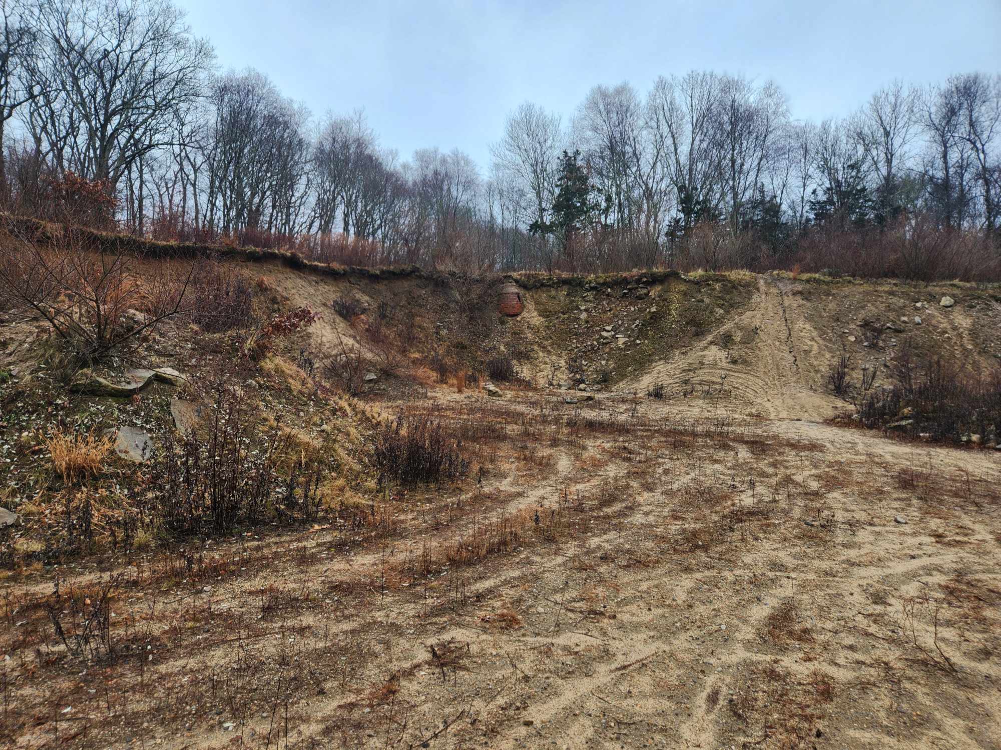
Be careful near the abandoned quarry
By Rob Smith / ecoRI News staff
At first glance, the Champlin Farm Preserve, despite its
name, doesn’t really look like a farm.
Jennifer Fusco, executive director of the Westerly Land Trust,
said the plan for the land is to keep the preserve's pastures
intact, while also opening the land to the public.
(Rob Smith/ecoRI News)
The 90 acres that make up the new preserve owned by the
Westerly Land Trust are full of forestland, hills, and rocky ledges. There are
no vast cleared fields for crops or other markers of agricultural production.
There are only a scattered few fields of pasture, ringed by ancient stone walls
constructed lifetimes ago.
If anything, prior to its acquisition by the Westerly Land
Trust earlier this year, the preserve was one of the few remaining slivers of
wilderness left in Westerly.
“This really is a special place,” Jennifer Fusco, executive
director of the Westerly Land Trust, said during a tour of the Champlin Farm
Preserve last month.
Last October, the land trust took ownership of the property, buying it from the Champlin family for some $1.5 million. The Champlins owned the land for decades, using it primarily during its heyday to pasture livestock and grow alfalfa and corn. Those days are long gone, and much of the property is overgrown with trees, shrubs, and a number of nonnative species that have taken over much of the land.
There’s still some slight farm activity. Fusco noted the
Champlin Family allowed cows from the nearby Beriah Lewis farm — across the
Pawcatuck River in Connecticut — to be pastured on several fields on the
preserve property, an agreement Fusco said the land trust is open to continuing
but wants in writing.
It’s the most activity much of the land has seen over the
past decade. As she walked across one of the bigger pastures, Fusco pointed out
the pink ribbons tied to trees every dozen or so feet. Workers from the land
trust, she said, have already done a first pass at trimming back some of the
undergrowth. Trees and shrubs have been seriously trimmed to make passable
trails throughout the property.
“There’s a lot of nonnative species we have to get under
control,” Fusco said.
The farm’s preservation wasn’t always a guarantee, she said.
The Champlin family, in order to get a better idea of the land’s value, had
originally drawn up a plan for subdividing and developing the 90 acres.
Raising the money to buy it wasn’t easy. Even with the
addition of state funds — which will preserve the land as farmland in
perpetuity — the Westerly Land Trust had to raise the rest from different
sources, including state Department of Environmental Management open space
acquisition funds and nonprofit foundations.
Farmland like the Champlin Farm Preserve is an endangered
species in Rhode Island. In 1945, the state contained 264,734 acres of working
farmland, spread across 3,603 individual farms. Today, thanks to 80 years of
population growth, suburban expansion, and development pressures, that figure
has dramatically shrunk.
The latest numbers from the U.S. Department of Agriculture
show the state has 61,223 acres of working farmland, across 1,054 farms.
It’s not hard to see why. There’s less money in farming;
it’s more lucrative to sell to housing or commercial developers who will build
residential subdivisions or strip malls, and fewer Rhode Islanders are farmers
than just after the second World War.
The land trust’s current vision for Champlin Farm is to keep
as much of it for pasture as it currently can, while concurrently opening the
land to the public in some way. Fusco said the land trust is still in the
beginning stages of drawing up a conservation management plan and has a lot of
decisions to make in the future.
A big part of that plan will remediating the 5-acre quarry on-site. Active until around 10 years ago, the quarry operation began earlier in the century to provide additional income on land that otherwise wasn’t being used. 🔜
Unlike the rest of the preserve, which appears at times
untouched entirely by human development, the quarry presents a safety hazard
for human use. From its bottom, the blasting has taken huge chunks of the
landscape, and much of what remains is compacted sand and dirt.
“We’re really lucky because the water quality [underneath
the quarry] seems good,” Fusco said. “We just don’t really know what the way
forward for the quarry looks like.”
Fusco said the land trust hopes to open the preserve to the
public sometime in the next year, most likely through a trail network the land
trust will create. The pink ribbons, which mark the trails where land trust
workers have trimmed undergrowth and created paths to access the land, will
likely become the start of a trail network.
